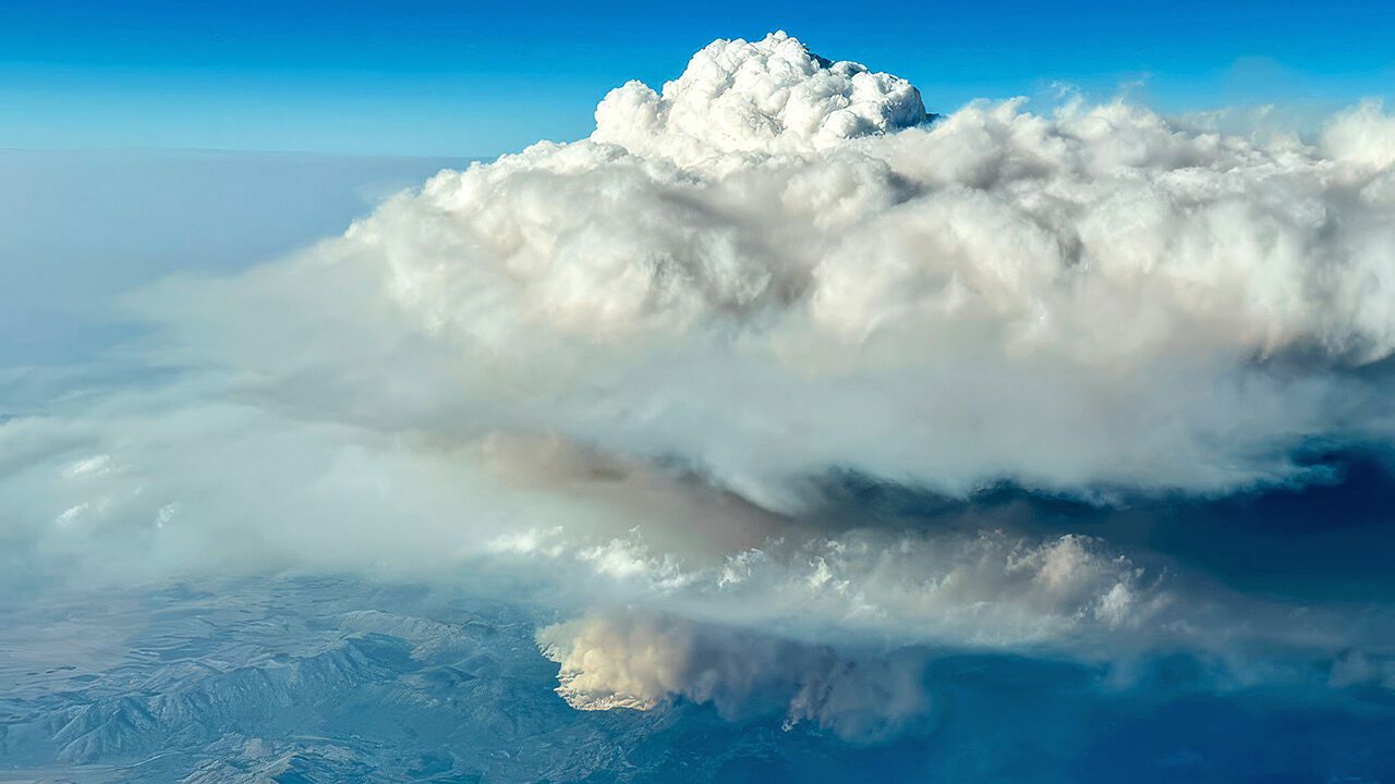
MOST AIRCRAFT try to avoid bad weather. Not so a Gulfstream V that taxi((飞机)滑行)ed onto the runway of Rocky Mountain Metropolitan Airport, in Colorado, on July 29th. Its flight path was set to take it directly into a rare and little-understood(鲜为人知的,了解甚少的) weather event—a pyrocumulonimbus (pyroCb)—in Oregon. Such towering, smoke-tinged storm clouds form above wildfires and generate weather that can multiply the damage of the fires that cause them.(这种高耸的、带烟色的风暴云在野火上方形成,并产生能成倍放大引发它们的火灾破坏力的天气。)
大多数飞机都试图避开恶劣天气。但7月29日在科罗拉多州落基山大都会机场跑道上滑行的一架湾流V型飞机却并非如此。它的飞行路线被设定为直接飞入俄勒冈州一场罕见且鲜为人知的天气事件——火积云(pyroCb)。这种高耸的、带着烟色的风暴云在野火上方形成,并产生能够成倍放大引发它们的火灾破坏力的天气。
The Gulfstream’s journey was the first flight of the INjected Smoke and PYRocumulonimbus Experiment (INSPYRE)—a joint mission between NASA, America’s aerospace agency, and that country’s Naval Research Laboratory (NRL). This project, led by David Peterson of the NRL, aims to measure pyroCbs in unprecedented(前所未有的) detail by collecting samples and monitoring a storm’s evolution from the inside out(从内到外). The resulting data, the team hopes, will help pin down(确定,查明) any role such storms play in Earth’s warming climate, and better equip(装备,使有能力) firefighters as they battle wildfires of increasing size and intensity. The summer of 2026 has brought some of the worst to date in America and Europe. In July France recorded its first ever pyroCb.
这架湾流飞机的旅程是“注入烟雾与火积云实验”(INSPYRE)的首次飞行——这是美国航空航天局(NASA)与美国海军研究实验室(NRL)的联合任务。该项目由NRL的戴维·彼得森领导,旨在通过收集样本并从内到外监测风暴演变,以前所未有的细节测量火积云。团队希望,由此获得的数据将有助于确定此类风暴在地球气候变暖中所扮演的角色,并更好地装备消防员,以应对规模和强度不断增加的野火。2026年夏季给美国和欧洲带来了迄今为止最严重的一些野火。7月,法国记录了其首个火积云。
Thunderstorms happen when warm, moist(潮湿的) air is driven rapidly upward. The air cools as it rises and its water vapour condense(凝结)s, forming clouds. In the right conditions, these clouds grow into towering cumulonimbi(积雨云(复数)), the roiling(翻滚的,搅动的) insides of which conjure(变出,产生) strong winds, lightning and hail.
当温暖潮湿的空气被迅速向上驱动时,就会发生雷暴。空气上升时冷却,其中的水蒸气凝结,形成云。在适当条件下,这些云成长为高耸的积雨云,其翻滚的内部会产生强风、闪电和冰雹。